Waymarked routes
There are four waymarked routes in the park, each starting from the car park on Hollygate Lane (although they can also be explored from other starting points). Routes can be followed from our park map, or by using the wooden posts with colour-coded bands found throughout the park. Each route can be taken in either the clockwise or anti-clockwise direction; we describe the clockwise route below.
The blue, green and red routes involve a short distance along the pavement beside Hollygate Lane road, turning into the park after crossing the canal. The pavement here is quite wide, and traffic should be travelling slowly, but please take care of children and dogs.
Yellow route - short (3km, flat)
The yellow route follows the path alongside the Hollygate Park housing estate, until it turns left onto a wide track that heads through a small patch of woodland, then over a bridge crossing the canal at Hollygate Lane Lock.
After crossing the canal, the yellow route turns right onto the towpath, until reaching Cotgrave Lock, where it crosses back across the canal. Following the path around to the right, the route passes Heron Lake on its way back towards the start point.
Blue route - medium (4km, slight climb)
The blue route starts alongside the canal, then takes the first path on the left, followed by a path on the right very shortly afterwards, travelling through some of the younger woodland in the park and heading towards Kingfisher Pond.
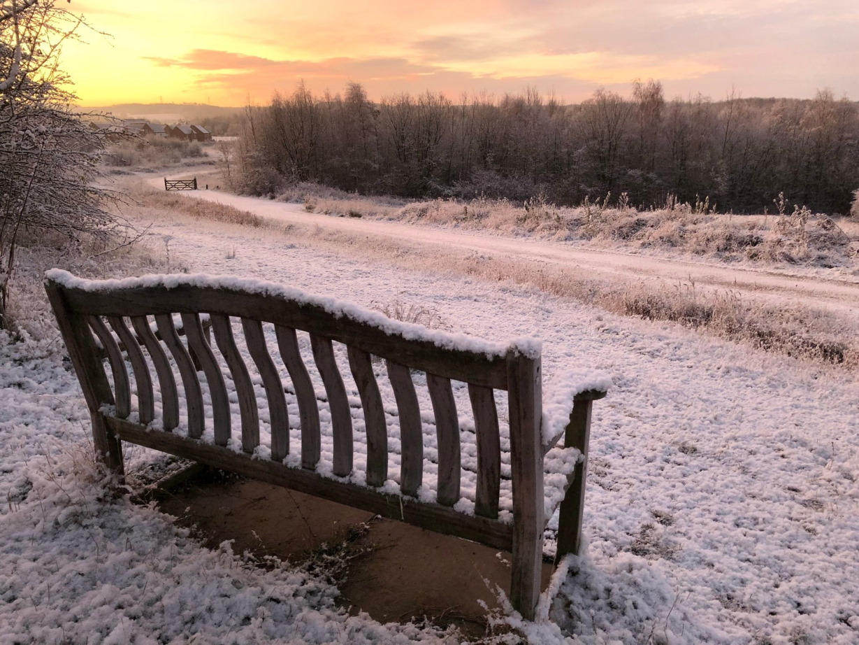
Arriving at the junction with the larger track, the blue route turns left up a slight hill, and follows the track as it curves gently to the right and joins the beautiful High Trail (pictured below), where we slowly descend back towards the canal.
Upon reaching the canal, the blue route doubles back on itself, following the canal towpath until reaching Cotgrave Lock, where it crosses the canal and returns back towards the car park, passing Heron Lake and the Hollygate Park housing estate on the way.
Green route - medium (4.75km, one small hill)
The green route follows the canal for approximately one mile, passing Hollygate Lane Lock and only crossing the canal after reaching the second lock, Cotgrave Lock.
After crossing the canal, the green route follows the path to the right, until after a short distance it reaches an opening with Heron Lake visible. At this point, the route turns left, following a large loop around the base of a hill at the north edge of the park.
As the route turns to head south, joining the track up Colliers Mount, there is a short but steep hill, which may be challenging for buggies etc., but offers excellent views towards Nottingham once climbed. From here the green route wanders gently down the back of the hill, joining the main track that passes Hollygate Park housing estate on its way back to the start point.
Red route - long (5.8km, two small hills, some steps)
The red route starts alongside the canal, then takes the first path on the left, heading into Bluebell Spinney. Taking the second turning on the right, across a small bridge, there is then a moderate flight of steps, which will be challenging for buggies etc.
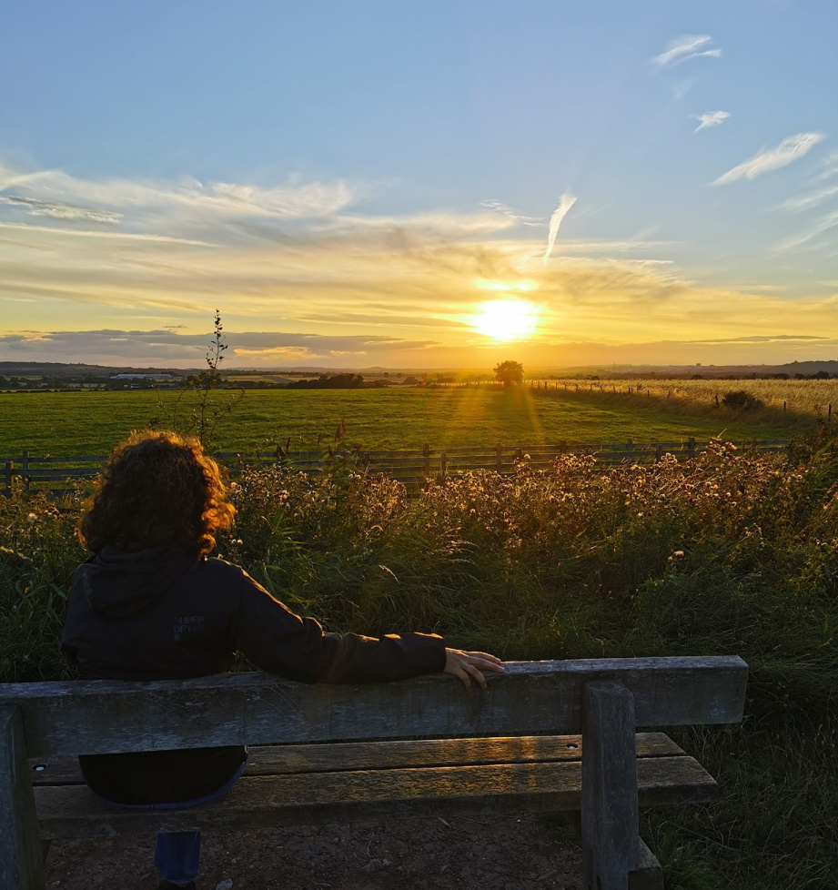
After climbing the steps, the red route turns into the woodland on the left, rising up towards West Viewpoint (pictured below, and the first of the two viewpoints along this route), where there are benches to enjoy the panoramic views towards Nottingham. The path then twists through a short section of woodland, before turning left onto High Trail and slowly descending towards the canal.
Upon reaching the canal, the red route doubles back on itself and follows the towpath, until it crosses the canal at Cotgrave Lock. From here, we follow the path to the right for a short distance, until reaching an opening with Heron Lake visible.
At this point, the red route turns left, following a large loop around the base of a hill at the north edge of the park. As the path turns south to head up Colliers Mount we encounter the second and steepest hill along this route, which may again be challenging for buggies etc. The crest of the hill provides the second viewpoint back towards Nottingham, and the path wanders gently down the back of the hill, joining the main track that passes Hollygate Park housing estate on its way back to the start point.